


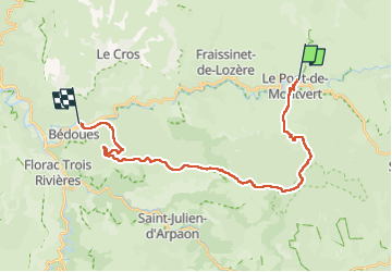
Stevenson Pont de Montvert - Bédouès

VANDERPUTTENMi
User GUIDE

Length
26 km

Max alt
1421 m

Uphill gradient
762 m
Km-Effort
37 km

Min alt
560 m

Downhill gradient
1102 m
Boucle
No
Creation date :
2024-05-22 05:40:22.219
Updated on :
2024-05-28 18:53:03.757
7h33
Difficulty : Very difficult

FREE GPS app for hiking
 SityTrail
IGN / Geographical institutes
SityTrail Plus
The world is yours!
About
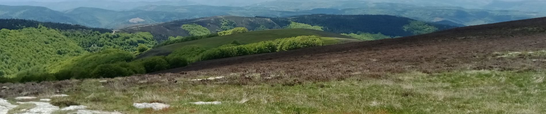
Trail Walking of 26 km to be discovered at Occitania, Lozère, Pont de Montvert - Sud Mont Lozère. This trail is proposed by VANDERPUTTENMi.
Photos


Positioning
Country:
France
Region :
Occitania
Department/Province :
Lozère
Municipality :
Pont de Montvert - Sud Mont Lozère
Location:
Unknown
Start:(Dec)
Start:(UTM)
559462 ; 4912736 (31T) N.
Comments